These models allow architects, engineers, and builders to test different design solutions and visualize how the structure will perform in the real world.

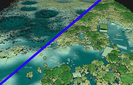
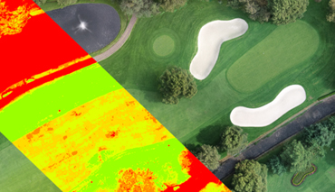
They are fundamental disciplines for the development of geospatial projects in various areas such as construction, mining, agriculture, natural resource management, among others.
The accurate and efficient detection of gases and pollutants is crucial in various sectors, such as the chemical industry, public safety, and environmental protection.
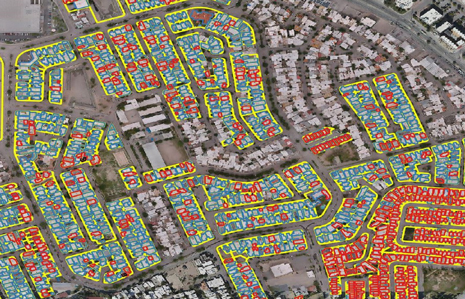
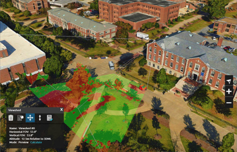
Understanding that each project has unique requirements, we offer tailored geospatial analysis solutions. Whether you're in urban planning, infrastructure development, natural resource management, or any other industry, we work closely with you to create solutions that address your specific challenges and goals.
At Geoearth, geospatial analysis goes beyond technology – it's about extracting meaningful insights from data sources to drive innovation, informed decision-making, and successful project outcomes. With our diverse range of expertise and cutting-edge tools, we're dedicated to providing you with the knowledge needed to transform your visions into reality.


Contact us and learn more about us.